QGreenland Documentation
What is QGreenland?
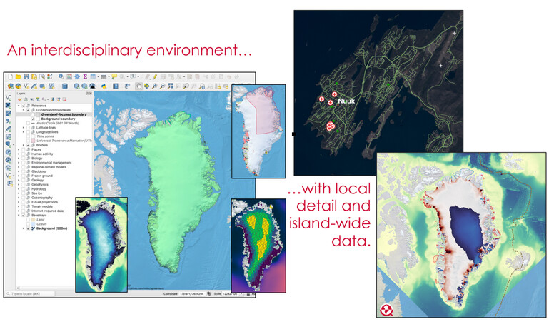
QGreenland is a free and open-source Greenland-focused GIS environment for data analysis and viewing, powered by QGIS. QGreenland is delivered as a Zip package containing a core set of data curated to serve a broad user base. This package is referred to as QGreenland Core.
See our tutorial on how to get started with QGreenland Core here!
Attention
The QGIS Plugin QGreenland Custom (beta) is no longer supported. This was an experiment, and we decided to go in a different direction. It should not be expected to work.
Visit the QGreenland website
What QGreenland is not
The QGreenland project is not a data-production project. While we do process existing data, it is only to enable efficient and effective viewing in the QGreenland QGIS environment.
QGreenland is not a navigational aid. Please see our Disclaimer.
About QGIS
QGIS is a free and open source Geographic Information System (GIS) licensed under the GNU General Public License. QGreenland is designed to be used by a diverse user group, from scientists to planners and policymakers to educators, and more. QGreenland users are able to produce high-quality mapping products to meet their unique needs. And because the QGreenland data package is downloaded right onto the user’s computer, QGreenland can be used in the field and in remote places without Internet access. Some additional larger datasets (e.g., satellite imagery) not included with the main QGreenland download package are available through online access when connected. QGreenland was inspired by the free and open source Quantarctica GIS data package for Antarctica.
QGreenland Core Download Package
You will find the following files in the QGreenland Core data package:
Folders containing data layers organized by topic. Each data layer is represented as a GeoTIFF or GeoPackage.
qgreenland.qgz - The main QGreenland project file for QGIS
qgreenland.png - The official QGreenland logo
layer_list.csv - A complete list of all the data layers in the QGreenland Core download package, including information about each (data source, file size, etc.). This file can be opened with Microsoft Excel, LibreOffice Calc, a text editor, or a similar program.
UserGuide.pdf - The full QGreenland Core User Guide
QuickStartGuide.pdf - A one-page overview guide for experienced QGIS users on how to download the QGreenland Core data package and other information
STYLE.txt - Guidelines and standards for QGreenland data layer styling
README.txt - Brief description of the QGreenland data package
CHANGELOG.txt - A log of changes made to the QGreenland data package
Please note that QGreenland Core v1.0.0 is the first stable public release version from this project. The QGreenland Core v2.0.0 download package was released in March 2022. The QGreenland Core v3.0.0 download package was released in August 2023. Development versions along the way will continue to be available via the website, with code fully documented on GitHub.
Although the v3.0.0 download package contains a full User Guide, updates and additions are constantly being made to our documentation as we continue to develop QGreenland. The most recent version of QGreenland documentation will always be available here on Read the Docs.
Citing QGreenland Core and Custom
We request that the QGreenland project be cited or acknowledged when publishing a QGreenland-made image or map.
QGreenland development is open source and available on GitHub. This means that users are free to create their own customized QGreenland package with different and new styles, layers, and data. Users who wish to contribute to the QGreenland project will find instructions on how to do this in the Contributor How-to section on Readthedocs.
QGreenland is licensed under an MIT license: Permission is hereby granted, free of charge, to any person obtaining a copy of this software and associated documentation files (the “Software”), to deal in the Software without restriction, including without limitation the rights to use, copy, modify, merge, publish, distribute, sublicense, and/or sell copies of the Software, and to permit persons to whom the Software is furnished to do so, subject to the following conditions: The above copyright notice and this permission notice shall be included in all copies or substantial portions of the Software.
Users should note that published works produced using QGreenland are required to cite each dataset used in the work. QGreenland provides all dataset citation information in each layer’s metadata in QGIS (see the Layer Properties section in the Interacting with Geospatial Data tutorial for instructions on how to access a layer’s metadata) and in the layer catalog provided with the QGreenland download package, layer_list.csv. You are also required to acknowledge or cite QGreenland and the National Snow and Ice Data Center in your work.
Citation
Please note that QGreenland currently has two citable components:
The QGreenland QGIS data package is cited as
[dataset]and used by researchers and educators.The software used to generate the QGIS data package from source data is cited as
[software]and used by software developers.
Please choose the appropriate citation depending on which you use.
An asterisk (*) indicates co-equal lead authorship (listed alphabetically).
Latest version: v4.0.0alpha4
Moon T., Stafford T., Marowitz R., Held R., Dryák-Vallies M., McGhee S., Fisher M. (2026). QGreenland (v4.0.0alpha4) [dataset], National Snow and Ice Data Center. doi: 10.5281/zenodo.8247895
Stafford T., Moon T., Marowitz R., Held R., Dryák-Vallies M., McGhee S., Fisher M. (2026). QGreenland (v4.0.0alpha4) [software], National Snow and Ice Data Center. doi: 10.5281/zenodo.4533271
Version 4
Moon T., Stafford T., Marowitz R., Held R., Dryák-Vallies M., McGhee S., Fisher M. (2026). QGreenland (v4) [dataset], National Snow and Ice Data Center. doi: 10.5281/zenodo.8247895
Stafford T., Moon T., Marowitz R., Held R., Dryák-Vallies M., McGhee S., Fisher M. (2026). QGreenland (v4) [software], National Snow and Ice Data Center. doi: 10.5281/zenodo.4533271
Version 3
Moon, T. A., M. Fisher, T. Stafford, and A. Thurber (2023). QGreenland (v3) [dataset], National Snow and Ice Data Center. doi: 10.5281/zenodo.12823307
*Fisher, M., *Stafford, T., T. Moon, and A. Thurber (2023). QGreenland (v3) [software], National Snow and Ice Data Center. doi: 10.5281/zenodo.8326507
Version 2
Moon, T., Fisher, M., Harden, L., Simonoko, H., and T. Stafford (2022). QGreenland (v2) [dataset], National Snow and Ice Data Center. doi: 10.5281/zenodo.8247915
*Fisher, M., *Stafford, T., Moon, T., Harden, L., and H. Simonoko (2022). QGreenland (v2) [software], National Snow and Ice Data Center. doi: 10.5281/zenodo.6369184
Version 1
Moon, T., Fisher, M., Harden, L., and T. Stafford (2021). QGreenland (v1) [dataset], National Snow and Ice Data Center. doi: 10.5281/zenodo.8247896
*Fisher, M., *Stafford, T., Moon, T., and L. Harden (2021). QGreenland (v1) [software], National Snow and Ice Data Center. doi: 10.5281/zenodo.4557875
Acknowledgement
We acknowledge the National Snow and Ice Data Center QGreenland package.